THE V-FORCE : 1955 to 1966
Navigation at 50,000 and 500 feet
Air Commodore Norman Bonnor FRIN FRAeS

This a very special web page for navigation specialists. It is included because nowhere else on the web as far as I know is there such a first class detailed account of the way the V force navigated. Not surprisingly Norman Bonnor, who wrote this definite account, became President of the Royal Institute of Navigation. I would have liked to have included it as a chapter in my book Victor Boys but unfortunately there was no room.
There can be little doubt that it is the most authentic explanation of how the V bombers were navigated anywhere and I am delighted that Norman Bonnor allowed me to have this account on my web site. It details so well how the navigators made the very best of their equipment before the days of inertial navigators and satellite navigation. Luckily the aircraft were never used in nuclear war but paradoxically really accurate navigation would probably never have been needed had a nuclear war occurred because of the lethal range of the weapons. Dropping practice bombs accurately on a small target was the greatest challenge for the navigators.

The first V-Force aircraft (Mk 1 versions of the Valiant, Vulcan and Victor) entered service in the late
50s, each equipped with a True Airspeed Unit, Green Satin Doppler radar, a Ground Position Indicator (GPI) Mk 4, the Navigation and Bombing System (NBS) which included the H2S Mk IXA ground-mapping radar, a radar altimeter, a periscopic sextant but, apart from a standby compass in the cockpit, their only heading reference was a single G4B gyro-magnetic compass. These were the navigation aids intended for use in the aircrafts' war role of strategic bombing. To meet peacetime requirements, particularly for standard instrument departure and arrival procedures, other navigation equipment included: a radio compass, the Instrument Landing System (ILS) and GEE Mk 3 later replaced by TACAN; I don't intend dealing with the use of these latter aids except to say that we also used the radio compasses for reception of Consol and, more importantly, to keep in touch with Test Match scores!
The major innovation when compared to earlier medium bomber aircraft of the RAF (ed Lancasters, Halifax) was the real time input of accurate drift and groundspeed from the Green Satin Doppler radar into the computations of a fully integrated navigation and bombing system. The NBS was a very complex group of analogue computers, which relied on the use of "chopper" amplifiers to cut up DC signals representing various parameters into pseudo AC for amplification. Among its many features were the calculation of forward throw and trail of a selected weapon and the output of accurate steering commands to the computed release point with an automated release signal; gone were the days of "pressing the tit". Unfortunately, the system was large and very heavy involving many "black boxes", or perhaps these are better described as "black dustbins", most of which had to be installed in the pressurised cockpit. The Green Satin Doppler was very reliable and, apart from occasional unlocking problems over calm seas and the inherent errors caused by sea surface motion, its velocity and drift accuracy easily met the long range Dead Reckoning (DR) requirements of strategic bombing. The same could not be said of the G4B compass. A great deal of effort was devoted to calibrating the compass using 12-point ground swings with Fourier analysis to smooth out observational errors and confirm the quality of the results, but large cross track navigation errors were still very obvious in the air despite the use of the NBS automatic variation unit which continuously applied a local variation value to the compass output. But before delving more deeply into the problem of compass errors, I should briefly describe the Navigation Team and the techniques we used in those early days of the V-Force.
Initially, most V-Force Captains were experienced bomber types with at least two tours under their belts but, within a few years, selection was opened to some of the first co-pilots who had joined the force straight from training and now had up to three years experience of the aircraft and role. By the mid 60s, most co-pilots came straight from training and included a proportion of young ground engineers on a flying tour to broaden their appreciation of aircrew needs; an excellent scheme which was unfortunately abandoned when their flying training was seen as too expensive for the time they spent on aircrew duty. One of the co-pilot's primary tasks was management of the fuel system and, as a third of the aircraft's weight without weapons was fuel, this involved C of G management as well. Some ground engineers also filled the Air Electronics Officer's seat; the AEO's role was a mixture of signaller, air engineer and defensive systems operator in that he looked after long range communications on the HF single side-band radio, he managed the electrical and hydraulic systems and controlled the radar warning systems, chaff dispensers and the multitude of high-powered jammers we carried.

The Nav Team comprised a Nav Radar, who had undergone a ten month training course at the Bomber Command Bombing School at Lindholme on radar scope interpretation and the detailed operation of the NBS system, and the Nav Plotter who, in those early days, had completed at least one previous flying tour with above average assessments. To navigate to the target area, the Plotter used a traditional flight plan proforma, a Lambert’s Conformal plotting chart, a separate navigation log (although “Log on Chart” techniques were adopted at an early stage), and the usual paraphernalia of Douglas protractor, Dalton computer, 4H pencils etc. During sortie planning, the Nav Radar used 1:250,000 topographical maps to select suitable radar fix points for the en-route phase, and large scale maps and aerial photographs to study the target area and to select offset aiming points for the target which usually was not a significant, individual return on the radar; two offset selections were available – internal and external. To help identify the target and related offsets, he would drawn an outline with a fine marker pen of the predicted radar echoes on a piece of acetate and, during a bombing run, he would hold this overlay on the Plan Position Indicator (PPI) to “map match” the radar picture and ensure the range and bearing markers were placed over the correct offset or target using the small joystick controller, the CU626. The offset distances were measured or calculated as accurately as possible in yards and set on the NBS as Northings and Eastings. Here is the second reason why compass errors were so important to the Nav Team; these offsets were measured against a True North datum, so any error in the true heading used by the NBS appeared directly in the bombing results. For example, using an offset 10,000 yards from the target (not a particularly long one) a degree of heading error would introduce more than 150 yards bombing error over and above any aiming, ballistics or other errors.
A new V-Force crew arriving on a squadron from the appropriate OCU (Operational Conversion Unit) was qualified to fly the aircraft safely and efficiently but not yet operational; their first task was to complete a number of training sorties, some ground training requirements and to study their assigned NATO and national war targets before they could be declared "Combat Ready". This was the first step on a complex six month training schedule to achieve, retain or improve their Bomber Command Classification as a "constituted" crew. All V-Force crews had to be a "constituted" group of five individuals who, because of the highly classified nature of the war role, the nuclear weapons, and the target materials, had been “positively vetted” before starting their OCU training.
Bomber Command imposed three navigation modes or techniques on the Nav Team for combat readiness training: Primary, Secondary and Limited. Primary allowed full use of all aids including radar fixing which made staying within about a ¼ mile of track and timing to better than 5 seconds very easy; in fact, the technique was too easy, and we hardly needed to practise its use. Secondary assumed loss of the radar picture for fixing to simulate a more "stealthy" penetration of enemy defences so denying the H2S transmissions for AI fighter or missile homing, but the Green Satin drift and groundspeed inputs were still available. This meant using other methods for updating present position with the emphasis on Astro as the war role demanded autonomy. For navigators from an earlier era, I should point out that visual "on- tops" are not usually available or very accurate from 50,000 feet. The V-Force took Astro techniques to their limit; the traditional three star fix was largely abandoned in favour of sandwich fixes formed from along and across track position lines by averaging at least five one minute sextant shots (in effect 300 individual measurements) with complex corrections applied for turning and longitudinal acceleration errors. A good crew would achieve errors of 3 to 5 miles at the terminal point of a 1000-mile navigation stage using the Secondary technique. Limited technique took away the Green Satin inputs as a simulated failure, leaving the True Airspeed feed and wind vectors set manually on the NBS. This was clearly more difficult, but if the high level winds were reasonably stable, a good crew would be inside 10 miles at the end of 1000 miles. Almost all the Plotters I flew with used track plots for all three techniques including Limited where fixes or MPPs were used to calculate "delta" values of the N/S and E/W wind vectors to update the NBS settings manually.

Achieving good track keeping and timing accuracy was not just an end in itself; to maintain credible deterrence, the bomber force was required to prove its capability to penetrate the extensive early warning and air defence systems of the Soviet Union. This capability relied on a co-ordinated attack plan on a broad front to saturate the defences using mutual support jamming of the many types of surveillance radar and air defence communication systems; this required very accurate track keeping and timing so that no gaps appeared in the jamming that might reveal individual bomber aircraft.
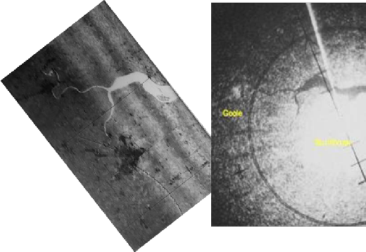
Height finding or fixing, very important for accurate bombing, was conducted over the sea or over flat terrain of known height as close to the target as possible using the radar altimeter to update the millibar setting on the barometric altimeter sub-system within the NBS. For weapons training, a few practice bombs were dropped on ranges around the UK coast and overseas, but these exercises were treated as academic training only. Most radar bombing practice was conducted as simulated attacks against Radar Bomb Scoring Units (RBSUs); these were modified AAA tracking radars with an accurate plotting capability based near the major city complexes of London, Manchester, Newcastle and Glasgow as well as a unit in East Anglia. They each covered a range of up to 40 targets of varying difficulty; crews could book attack times before take-off or call for an opportunity attack; bomb release was simulated by the end of a tone transmitted by the aircraft on UHF radio which automatically lifted a pen on the radar plotting table; the RBSU staff then used their tracking radar's values of track, speed and height to calculate the forward throw and trail of a simulated weapon and estimate the impact error.
But back to our real problem, the gyro-magnetic compass. The crews knew it was the weak link which is why so much attention was paid to reducing residual deviations by elaborate ground compass swings. However, at squadron level, not much was known or understood about compass errors caused by flying rhumb line headings at 500 knots. On XV Squadron, we elected to air swing the compasses of all our Victor Mk 1A aircraft using Astro as the reference. To do this with sufficient accuracy, we fitted "Vernier" scales to the sextant azimuth rings and calculated the sun's azimuth to 0.1 of a degree by interpolating the values in the yellow band AP3270. To our amazement, all eight of the squadron aircraft showed a very similar pattern of errors, with apparent residual deviations of over two degrees on SW headings; no wonder we were suffering large cross track navigation errors. Later, when I left the V-Force to complete the Staff and Specialist Navigation courses, I learned how to calculate these hang-off errors caused by the time constant of the compass control loop and the real and apparent drift of the gyro. Back on the squadron, we started using the airswing deviations, and our navigation performance and bombing results immediately improved. We also developed and used another technique to reduce the effect of compass errors on our bombing. This involved making the initial line up on the target with an abeam offset so that any compass errors were manifested along track as range errors; in the late stages of the run (10 or 15 seconds to release) the Nav Radar would tell the pilot to select the autopilot to Heading mode so that it no longer followed the NBS steering command; he then switched to a second offset in the overshoot and took out the range errors on this new offset just prior to the release point. This method required good planning but paid dividends in the results achieved.
Having solved the heading problem for high level navigation and bombing, the Soviets intervened
by increasing their deployment of surface-to-air-missiles. For some time, we had trained to defeat the SA1 and SA2 systems deployed around Moscow, and other major targets, by jamming their fire control radars and by weaving our heading throughout the bombing run so that their prediction systems could not track for long enough to achieve a successful engagement. But by 1963, the SA3 was deployed in large numbers with almost complete coverage along the Soviet border and in depth around our planned targets or Accounting Line Numbers (ALNs) as they were known. To maintain the credibility of deterrence, tactics had to change; it was time to operate as individual aircraft and go low level to penetrate under the surveillance radar cover and below the effective height of the SA3 system; in reality, this meant not more than 500 feet above ground and lower over the tops of ridges and hills.
Low level navigation was new to most of us. At high level, the pilots had flown on instruments and, for the operational role, covers were fitted over the cockpit windows to shield their eyes from the flash effects of other nuclear bursts; now some of the forward covers were removed, and the pilots were issued with an eye patch so that at least two eyes out of four would still be available after flying close to someone else's weapon. The low level navigation technique we developed involved the Plotter giving a running commentary of the expected scene ahead from prepared ½ million topos which the pilots attempted to confirm whenever they were in visual contact. Meanwhile, the Nav Radar used terrain features in preference to cultural fix points to check and update the NBS position at regular intervals. Terrain screening on the radar picture was very pronounced below 500 feet, and the important characteristic for a feature to show changed from what it was made of - metal or brick - to how high it was. Often a field pattern created by stone walls or hedges, or railway embankments, were much more prominent features than towns or industrial areas.
In the early 60s, some of the Valiant aircraft went out of service as bombers and were converted to the tanker role, and the Mk 2 versions of the Vulcan and Victor entered service. At first, the better performance of the Mk 2 Victor and Vulcan meant that our primary attack profile was still at high level (up to 60,000 ft where the air is thin and the sky so dark blue that Astro sights could be taken on the planets and brightest stars in the daytime), but soon the Soviet aircraft and missile threat meant that we joined our colleagues still on the Mk 1s at low level. Apart from slightly modified versions of Green Satin and NBS, the initial navigation fit of the Mk 2s was the same as the Mk 1s except for the compass. The G4B was replaced by twin gyro-magnetic compasses incorporated as part of the Smiths Military Flight System. Unfortunately, these suffered from very similar errors to the G4B but did have the added advantage that the pilots could now select to fly heading or track on a true or magnetic datum; I was never convinced that they really understood the difference!

The next change came with the introduction of the Blue Steel missile which gave a stand-off range of up to 150 miles at 50,000 feet or 50 miles at low level; with it came the GPI Mk 6, probably the most accurate analogue aircraft computer ever built, and the Inertial Navigation System (INS) of the missile itself. The aircraft could make use of the outputs of this system until the missile was launched. At last, an accurate source of true heading once the INS was aligned, but here was the rub; the deterrent role of the V-Force involved rapid reaction from the famous 4-minute warning from the Ballistic Missile Early Warning System at Fylingdales on the North York Moors, hence no time for a conventional 15 to 20 minute ground alignment. Airborne alignments had to be used; this was long before the very accurate Global Positioning System (GPS) and the rapid in-motion alignments of Ring Laser Gyro INS now take for granted by today's aircrew.
As well as the GPI Mk 6, one of the other modifications to the aircraft for the carriage and operation of the missile was the Blue Steel Control Panel (BSCP), which was not a normal piece of military avionics. It looked more like a fancy multi-meter about 10" x 8" inset in the Nav Plotter's chart-table (central in the rear cockpit) with a Perspex cover so that it could be read without disturbing the chart and plotting instruments in use. The meter had a variety of scales with different readouts selected by a multi- function switch, and one of its primary uses was to monitor the temperatures in the HTP tanks of the missile (two tanks if I remember correctly or at least two temperature sensors). This was crucial to safety as any contamination of the HTP (a super-oxidant) would make it boil and become a major hazard, particularly with a nuclear warhead nearby! This was why the QRA aircraft had to be visited by the alert crews regular intervals throughout the day and night to confirm all was well, particularly when an aircraft/missile combination first came on state. The crew chief and other ground crew were not permitted to enter the cockpit once targeting materials were in place and the aircraft declared. If I remember correctly, each operational missile on the station had to be flown once a quarter to meet Bomber/Strike Command goals. When we flew with these so-called "wet" missiles (without warheads of course) rather than training rounds, HTP temperatures were one of the items checked and logged every 30 minutes throughout the sortie. Should the HTP temperatures rise while airborne, the crew would divert immediately to the nearest "Blue Steel Diversion" airfield to offload the HTP into large tanks of water buried in the ground close to the ORP. There were several of these specially equipped airfields around the country apart from the main bases at Scampton and Wittering. The Co-pilot and Nav Radar where the offload crew who donned plastic suits after landing and connected hoses to the missile (this offload kit was kept in the visual bomb-aiming position); a very awkward operation with hard rubber gloves on and a face mask that kept steaming up! We had to practice this procedure regularly as a part of the six-monthly training requirements.
After a scramble take-off, which the first aircraft using a simultaneous “combustor” start of all four engines could achieve within 50 seconds (I don’t know of any fighter aircraft that can achieve such a time today), the INS alignment was completed by the Nav Team using the GPI Mk 6, the NBS and the BSCP in what can only be called a "mandraulic" manner; i.e. each step was separately initiated, carefully monitored and required a large number of switch selections; very different to the automated alignment sequence of modern Inertial Reference Systems. During the alignment process, the BSCP meter was used to monitor various parameters including: gyro temperatures and rotation speeds, torqueing motor currents on the gimbal rings. Another pole switch and indicator on the panel was the “LEDEX” switch. This was used to activate INS alignment using a numbering system so, for example, LEDEX 1 turned on the gyro heaters, LEDEX 2 locked the gimbals to the missile frame (hopefully reasonably level), LEDEX 3 spun the gyros up to speed etc. etc. In other words, the Nav Plotter manually selected each step of the alignment process (checking the indications as he did so); this process was totally automated for ground alignments of later INS used in aircraft such as the Phantom, Jaguar, Harrier and Tornado.
The penultimate LEDEX position put the INS into a mode where Green Satin Doppler velocities (N/S
& E/W) were compared with the IN velocity outputs, and the differences used to torque the INS stable platform and its leveling gyros. The assumption was that the Doppler velocities were correct, and that if the IN velocities were the same then the platform must be at right-angles to the local earth gravity vector. The INS was initially aligned in azimuth using the aircraft’s gyro-magnetic compass reading corrected for variation, and then continually corrected throughout the sortie using a Fix Monitored Azimuth (FMA) technique. This involved the Nav Radar using the H2S radar (either with the PPI or the Rapid Processing Unit (RPU)) to fix the GPI Mk 6 as accurately as possible and letting it run using IN heading for 150-200 nm (about 20 minutes flight) in a reasonably straight line, when he fixed again. The assumption was that any across track error was caused by IN azimuth gyro error, and this was torqued out automatically by accepting the fix on the GPI Mk 6 with other settings made that represented the track and distance between the fixes. The GPI Mk 6 was the key element in the integrated navigation system having been designed specifically to act as the interface between the aircraft navigation system and the missile but, because of its complexity, it was removed from the Victor Mk2 and replaced with the old reliable GPI Mk 4 when the aircraft were converted to the tanker role. Later, they were equipped with a Litton 211 Omega Navigation System and, during the Falklands war, with an AC Delco Carousel INS.
The FMA process, and clamping the IN velocities to Green Satin values, continued throughout the sortie or until missile launch. In the final preparations for launch, the last position fix was taken on a Release Point Fix (RPF). The RPF was the basis for defining the target position. Distances (N/S and E/W in minutes and decimal minutes of latitude and longitude) between the RPF and the target (or more correctly the position of the airburst height above the target) were set on the GPI Mk 6 and transmitted to the missile during the pre-launch checks so that the missile guidance and autopilot would know the target position very accurately. As the launch point was approached, the Nav Radar used the RPF to make the last corrections and, once these were accepted, the Nav Plotter selected the missile INS to FREE. At this stage it was then running as a space-stabilised system based on the RPF with no further Green Satin or FMA updates. Of course there were other final actions to perform, interspersed with the above, to release the missile including: unfolding the bottom fin at the rear of the missile, withdrawing the motorized locking pin on the missile release unit, pressurizing the fuel and High Test Peroxide (HTP) tanks, starting the missile auxiliary power unit etc.


The Nav Plotter activated the final launch switch, and the missile would hopefully fall away under gravity. To prevent the rocket motor firing too close to the launch aircraft, a 100 foot lanyard remained attached to the missile and, when this separation distance was reached, a pin was extracted that enabled the kerosene fuel and HTP to flow onto a silver catalyst screen in the Spectre rocket motor. Ignition was almost instantaneous and a thrust of 24,000 lbs was now pushing a missile weighing 16,000 lbs. You have to remember that Blue Steel was a pretty “slick” aerodynamic shape and, at launch, the canard foreplane was set at 15 degrees nose-up, the maximum angle. So, as it fell away, it stayed pretty well under the aircraft and gradually pointed its nose up until the motor fired when a 1.5:1 thrust to weight ratio rapidly accelerated it to Mach 3 in a steep climb, hopefully without colliding with the launching aircraft!
In training, missile guidance accuracy was assessed by simulating missile launch and allowing the
INS to run free while the aircraft performed a manoeuvre designed to emulate the same effects on
performance as the missile's Mach 3 flight profile would impose after a real launch. By this stage, the Victor Mk 2 had been fitted with a side-scan radar capability and a Rapid Processing Display Unit. When in use, the H2S scanner was locked at 90 degrees to aircraft track (port or starboard) and radar video diverted from the normal PPI display to a low afterglow CRT across which photographic paper was drawn at a speed proportional to the groundspeed of the aircraft. The exposed image was developed by passing the paper over two slots through which developing and fixing chemicals were sucked. Although it sounds hazardous to employ hot and corrosive chemicals in a pressurised aircraft cabin, the system was successful in that the radar image produced was much sharper and with a much wider spectral range than the normal high afterglow PPI; of course, it also produced a permanent image which allowed the Nav Radar time to study the returns more carefully before making any updates. The RPU was only fitted to the Victor Mk 2; I believe this small scale introduction was really aimed at developing the technique for the ill-fated TSR2 in which an RPU based side-scan radar was the primary fixing aid. The Vulcan Mk 2 aircraft that were not selected to carry the Blue Steel missile were retrofitted with a twin-gyro platform that provided similar heading performance to an INS rather than the poor accuracy of the gyro-magnetic compass.
In many respects, the Valiant, Vulcan and Victor and their fully integrated navigation systems were ahead of their time and allowed the RAF to skip over a generation of strategic bombers based on piston- engined aircraft with pressurised cockpits such as the Stratofortress. It was a major step to jet-age strategic bombers which, although designed for operation at ultra-high level also performed very well in the low level role. However, a major part of the V-Force success as a deterrent was down to the skill and flexibility of the aircrews, and the quality and resourcefulness of the supporting ground crews and operations staff; I am proud to say that I was part of it on both XV and 100 Squadrons flying the Victor Mk 1A and Mk 2.

